This article was translated by John R. Bopp
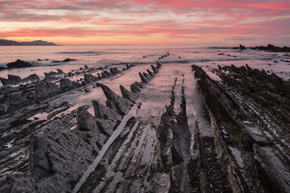
On January 23, the National Geographic website chose a photograph by M. Subirats on the Basque coast near Deba, in the Basque Coast UNESCO Global Geopark, as the Photo of the Day.
This just happens to coincide with the publication of our “Viewpoints” entry on Mutriku, which is a Guipuzcoan town that is near this extraordinary geological formation that shows us millions of years of Earth’s history.
As we said in our Mutriku entry, the Basque Coast Geopark stretches from Mutriku to Zumaia and is, without a doubt, one of the must-see places for any visitor to our coast. We again state our promise to dedicate a special episode of “Viewpoints” to this unique part of our country’s geography.
And we will, but in the meantime, we’re going to show off this image that offers a spectacular view of the coast of the Land of the Basques, which has captured all the beauty that can be found at the end of a cold, sunny January day.
National Geographic – 13/1/2017 – USA
PHOTO OF THE DAY: Basque Coast Unesco Global Geopark


Spain’s Basque Coast, part of which is pictured here, is so full of stunning landscapes, such as karst cliffs that lead into the sea and are worn over millions of years into coastal rock strata like these, that the area has been added to the European and Geoparks Network, administered by UNESCO.
(Continue)
UNESCO
BASQUE COAST UNESCO GLOBAL GEOPARK
The Basque Coast UNESCO Global Geopark is located on the western coast of Gipuzkoa Province, within the Basque Country, in northern Spain and very close to France. Basque Coast UNESCO Global Geopark is a mountainous area next to the Cantabrian sea with heights of 1.000 m inland and a very narrow valley. The coastal strip is at a lower altitude and oriented ESE-NWN.
(Continue) (Automatic Translation)
Last Updated on Dec 20, 2020 by About Basque Country


