The Library of Congress is one of those places that we’d love to get lost in, with full access to its resources, and spend half a lifetime just discovering what marvels it houses. And even that would only begin to scratch the surface of a collection of:
more than 32 million catalogued books and other print materials in 470 languages; more than 61 million manuscripts; the largest rare book collection[54] in North America, including the rough draft of the Declaration of Independence, a Gutenberg Bible (originating from the Saint Blaise Abbey, Black Forest) (one of only three perfect vellum copies known to exist);[55][56][57] over 1 million U.S. government publications; 1 million issues of world newspapers spanning the past three centuries; 33,000 bound newspaper volumes; 500,000 microfilm reels; over 6,000 titles in all, totaling more than 120,000 issues comic book[58] titles; films; 5.3 million maps; 6 million works of sheet music; 3 million sound recordings; more than 14.7 million prints and photographic images including fine and popular art pieces and architectural drawings;[59] the Betts Stradivarius; and the Cassavetti Stradivarius. (Wikipedia)
So a whole universe of interesting things to discover. Plus, the collection is only getting larger, and its resources are also available online.
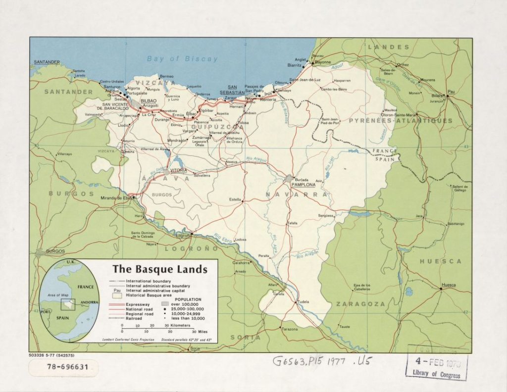
One of the elements they’ve scanned in is a 1977 map the CIA published under the title “The Basque lands”.
We don’t think too many comments are necessary. The image, the map, says it all, don’t you think?
Library of Congress – -USA
Maps- The Basque lands

Title: The Basque lands.
Contributor Names: United States. Central Intelligence Agency.
Created / Published: [Washington : Central Intelligence Agency, 1977]
(Follow)
Last Updated on Dec 20, 2020 by About Basque Country


